Land in. Plots out.
Clairvyn Layouts is a land layout tool for developers, planners, architects and surveyors. Bring a survey sheet or a photo of the land and it lays out the most plots on legal roads, with open space, public purpose and affordable housing land reserved, drawn as an approval-style sheet in DXF and PDF to your local rules.
Drawn for approval. Every road, park and plot on one sheet.
Every plot sized. Sides in feet, areas in sq ft and m².
Roads by their length. As wide as the rule asks.
Open space first. Parks and reserved land set aside.
Then the numbers. Area statement, legend and notes.

Any shape of land. Curved edges, odd angles.


To your region’s rules. You enter the local values.
- 7.2 m23'7"Internal roads, wide by their length from junction to junction
- 1.5 m4'11"Corner splays, square at every junction
- 1.5 m4'11"Front setback on roads up to 9 m (29'6") wide
- 3 m9'10"Front setback on roads up to 18 m (59'1") wide
- sq ftm²The smallest, best and largest plot, in either; the layout aims for the best
Every plot, scheduled. Sheet two, in DXF and PDF.
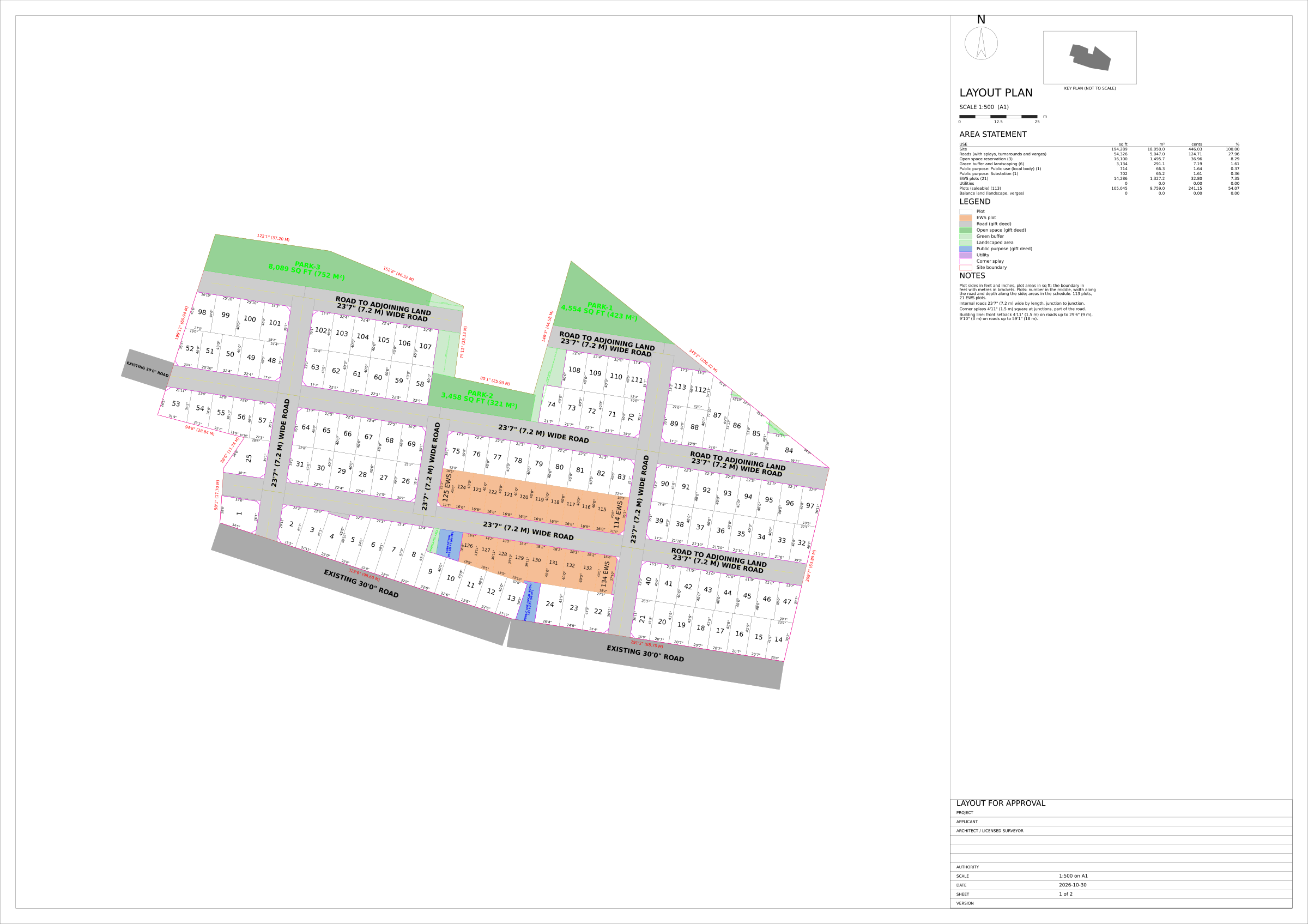
In detail. Land into plots.
The layout
- Land into plots
A survey sheet or photo in, the most plots out, on roads to your rules, with open space, public purpose and affordable housing land reserved; DXF and PDF out
- Rules
Any region's: enter the local values once and every layout follows them
- Plot sizes
Set the smallest, best and largest plot, in square feet or square metres; the layout aims for the best size
The site
- Sites in several pieces
Each piece gets its own sides and neighbours, named on the sheet
- Burial grounds and crematoria
Plots kept back as far as you choose; the land along it becomes park, and plots near it are priced lower
- Utility parcel
A transformer or pump room parcel only when you ask for one
Roads and plots
- Roads by length
Each road is as wide as the rule asks for its length from junction to junction, and the layout keeps rows short enough for the narrowest legal road
- Affordable housing plots
Sized like the house plots beside them and kept together, the way approved layouts draw them
- Leftover to the plots
Land left at the boundary or between rows goes to the plots beside it, the way approved sheets draw row-end plots
- Short frontage
A plot that meets its road for less than the least frontage is kept, priced hard to sell, and says how many metres and feet it meets the road
The sheet
- Approval-style sheet
Drawn the way approval sheets are: plot numbers with widths along the road and depths along the side, block outlines, named roads and parks, a plot schedule
- Versions to compare
Each version shows its plots, the plots that are hard to sell and any unused land; every check shows how far it clears the code minimum
- Extras
Hover a road for its width and the rule behind it, a plot for its size and anything that lowers its value; hard-to-sell plots are marked
Questions
What does Layouts do?
It turns a piece of land into plots. Give it a survey sheet or a photo of one, and it lays out roads, open space, public purpose and affordable housing land and the plots, and draws the sheet with its plot schedule, in DXF and PDF.
Which rules does it follow?
Your region's. Enter the local rule values once (road widths, splays, setbacks, the shares of open space and reserved land, plot sizes) and every layout follows them.
Can I choose the plot sizes?
Yes. Set the smallest, best and largest plot in square feet or square metres; the layout aims for the best size.
Does it handle odd sites?
Yes: curved edges, sites set at an angle, L shapes, sites with several road sides and sites in several pieces, each piece with its own sides and neighbours.